ملف:Jammu and Kashmir in 1946 map of India by National Geographic.jpg

حجم هذه المعاينة: 769 × 599 بكسل. الأبعاد الأخرى: 308 × 240 بكسل | 616 × 480 بكسل | 985 × 768 بكسل | 1٬280 × 998 بكسل | 1٬551 × 1٬209 بكسل.
الملف الأصلي (1٬551 × 1٬209 بكسل حجم الملف: 429 كيلوبايت، نوع MIME: image/jpeg)
| هذا ملف من ويكيميديا كومنز. معلومات من صفحة وصفه مبينة في الأسفل.
كومنز مستودع ملفات ميديا ذو رخصة حرة. |
ملخص
| الوصف |
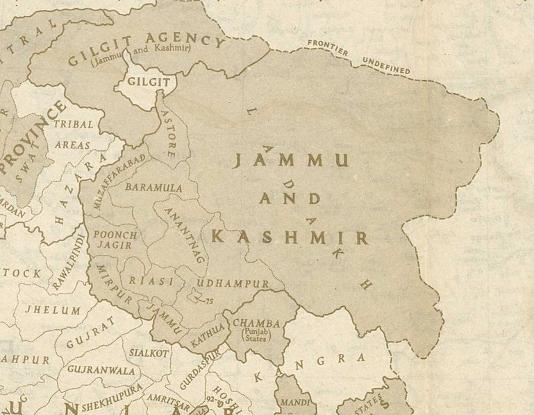
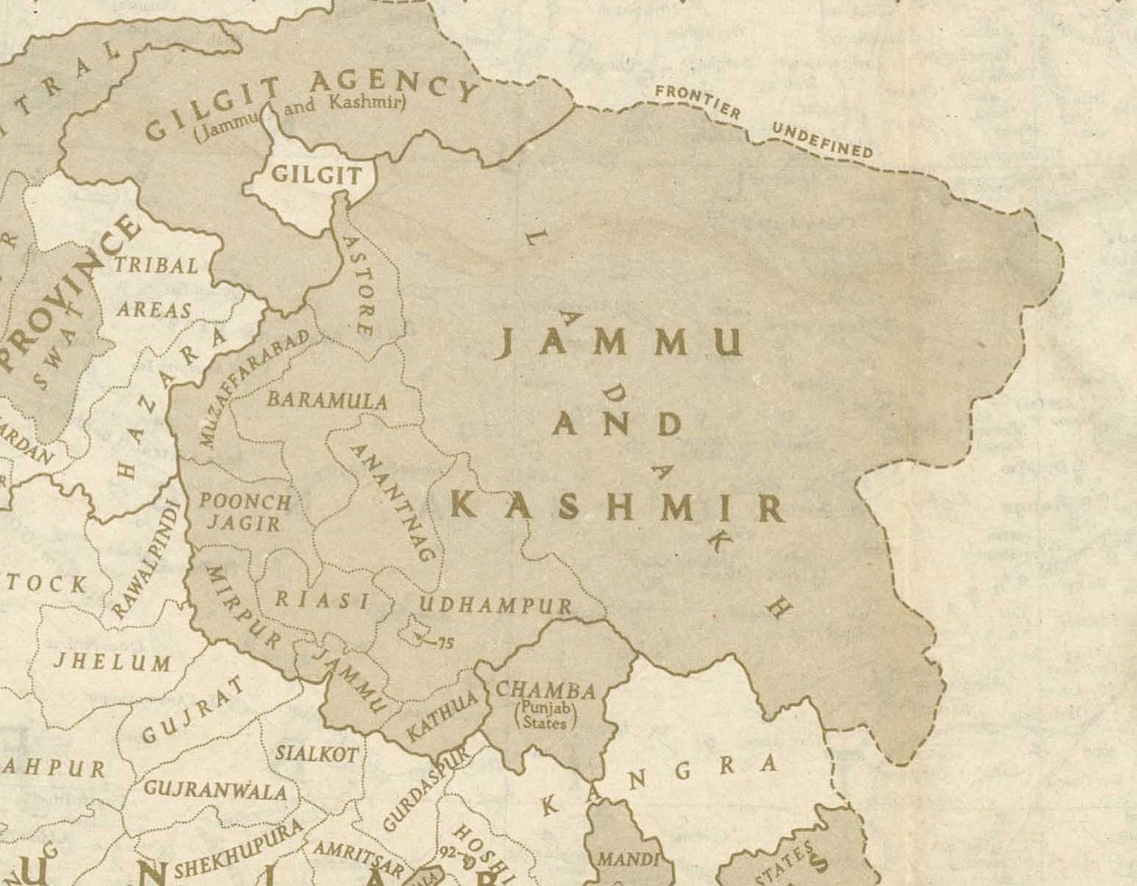
English: This is one of the last few maps of Jammu and Kashmir produced during the British Raj, just before the independence of India and Pakistan |
| التاريخ | |
| المصدر | http://pahar.in/wpfb-file/1946-political-subdivisions-of-india-by-national-geographic-jpg/ |
| المؤلف | National Geographic |
| إصدارات أخرى |

ترخيص
This media file is in the public domain in the United States. This applies to U.S. works where the copyright has expired, often because its first publication occurred prior to January 1, {{{year}}}, and if not then due to lack of notice or renewal. See this page for further explanation.
|
 | |
 |
تاريخ الملف
اضغط على زمن/تاريخ لرؤية الملف كما بدا في هذا الزمن.
| زمن/تاريخ | صورة مصغرة | الأبعاد | مستخدم | تعليق | |
|---|---|---|---|---|---|
| حالي | 20:48، 21 أكتوبر 2020 | | 1٬551 × 1٬209 (429 كيلوبايت) | Kautilya3 | Uploaded a work by National Geographic from http://pahar.in/wpfb-file/1946-political-subdivisions-of-india-by-national-geographic-jpg/ with UploadWizard |
استخدام الملف
الصفحتان التاليتان تستخدمان هذا الملف:
الاستخدام العالمي للملف
الويكيات الأخرى التالية تستخدم هذا الملف:
- الاستخدام في bn.wikipedia.org
- الاستخدام في en.wikipedia.org
- Azad Kashmir
- Gilgit Agency
- Poonch Jagir
- Talk:Sino-Indian border dispute
- Jammu and Kashmir (princely state)
- Gilgit-Baltistan
- Elections in Jammu and Kashmir
- Ardagh–Johnson Line
- 1947 Jammu massacres
- Template:User J&K princely state
- Wikipedia:Userboxes/Location/Kashmir
- Forward policy (Sino-Indian conflict)
- 1947 Gilgit rebellion
- User:Falcaorib/India and Pakistan
- الاستخدام في en.wikivoyage.org
- الاستخدام في hi.wikipedia.org
- الاستخدام في ko.wikipedia.org
- الاستخدام في nl.wikipedia.org
- الاستخدام في sd.wikipedia.org
- الاستخدام في te.wikipedia.org
- الاستخدام في zh.wikipedia.org