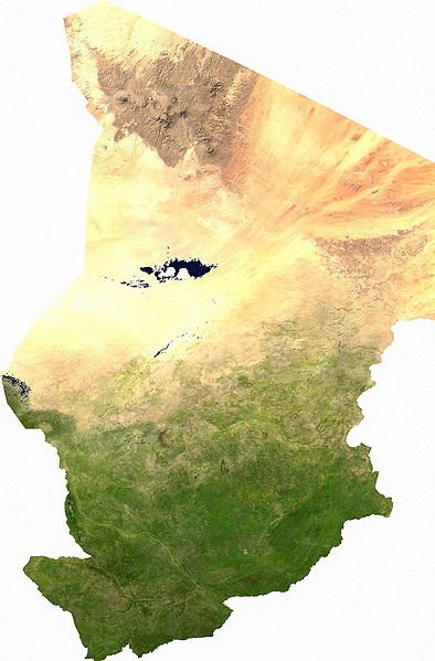
ملف:Chad sat.jpg

حجم هذه المعاينة: 394 × 599 بكسل. الأبعاد الأخرى: 158 × 240 بكسل | 316 × 480 بكسل | 505 × 768 بكسل | 1٬265 × 1٬922 بكسل.
الملف الأصلي (1٬265 × 1٬922 بكسل حجم الملف: 1٫79 ميجابايت، نوع MIME: image/jpeg)
تاريخ الملف
اضغط على زمن/تاريخ لرؤية الملف كما بدا في هذا الزمن.
| زمن/تاريخ | صورة مصغرة | الأبعاد | مستخدم | تعليق | |
|---|---|---|---|---|---|
| حالي | 03:43، 13 يوليو 2006 |  | 1٬265 × 1٬922 (1٫79 ميجابايت) | Unquietwiki | ECW to TIFF to JPEG (100% quality; progressive formatting). {{PD-MapLibrary}} |
استخدام الملف
الصفحتان التاليتان تستخدمان هذا الملف:
الاستخدام العالمي للملف
الويكيات الأخرى التالية تستخدم هذا الملف:
- الاستخدام في af.wikipedia.org
- الاستخدام في als.wikipedia.org
- الاستخدام في bg.wikipedia.org
- الاستخدام في bs.wikipedia.org
- الاستخدام في ca.wikipedia.org
- الاستخدام في da.wikipedia.org
- Tchad
- Tchads historie
- Wikipedia:Dagens skandinaviske artikel/september 2009
- Wikipedia:Dagens skandinaviske artikel/Svensk/Uge 36, 2009
- Wikipedia:Dagens skandinaviske artikel/august 2012
- Wikipedia:Dagens skandinaviske artikel/Bokmål/Uge 32, 2012
- Wikipedia:Dagens skandinaviske artikel/maj 2014
- Wikipedia:Dagens skandinaviske artikel/Søndag/Uge 20, 2014
- الاستخدام في de.wikipedia.org
- الاستخدام في de.wikiversity.org
- الاستخدام في el.wikipedia.org
- الاستخدام في en.wikipedia.org
- الاستخدام في eo.wikipedia.org
- الاستخدام في es.wikipedia.org
- الاستخدام في eu.wikipedia.org
- الاستخدام في fa.wikipedia.org
- الاستخدام في fr.wikipedia.org
- الاستخدام في hu.wikipedia.org
- الاستخدام في ig.wikipedia.org
- الاستخدام في is.wikipedia.org
- الاستخدام في it.wikipedia.org
- الاستخدام في ja.wikipedia.org
- الاستخدام في ka.wikipedia.org
- الاستخدام في kk.wikipedia.org
- الاستخدام في li.wikipedia.org
- الاستخدام في mn.wikipedia.org
- الاستخدام في nn.wikipedia.org
- الاستخدام في no.wikipedia.org
اعرض المزيد من الاستخدام العام لهذا الملف.
