ملف:North Yorkshire UK relief location map.jpg

حجم هذه المعاينة: 800 × 582 بكسل. الأبعاد الأخرى: 320 × 233 بكسل | 640 × 466 بكسل | 1٬024 × 745 بكسل | 1٬280 × 932 بكسل | 1٬999 × 1٬455 بكسل.
الملف الأصلي (1٬999 × 1٬455 بكسل حجم الملف: 466 كيلوبايت، نوع MIME: image/jpeg)
| هذا ملف من ويكيميديا كومنز. معلومات من صفحة وصفه مبينة في الأسفل.
كومنز مستودع ملفات ميديا ذو رخصة حرة. |
| الوصف |
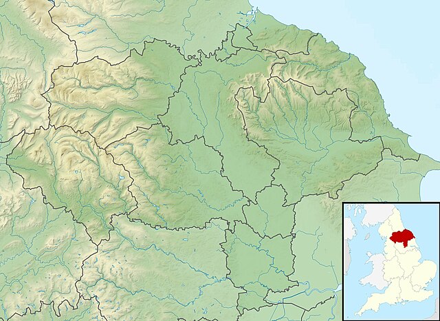
Relief map of North Yorkshire, UK. Equirectangular map projection on WGS 84 datum, with N/S stretched 170% Geographic limits:
|
| التاريخ | |
| المصدر |
|
| المؤلف | Nilfanion, created using Ordnance Survey data |
| الترخيص (إعادة استخدام هذا الملف) |
هذا الملفُّ مُرخَّص بموجب رخصة المشاع الإبداعي نسبة المُصنَّف إِلى مُؤَلِّفه - المشاركة بالمثل 3.0 العامة نسب العمل لمُؤَلِّفه: Contains Ordnance Survey data © Crown copyright and database right
|
| إصدارات أخرى | File:North Yorkshire UK district map (blank).svg - Blank map |
.svg)
تاريخ الملف
اضغط على زمن/تاريخ لرؤية الملف كما بدا في هذا الزمن.
| زمن/تاريخ | صورة مصغرة | الأبعاد | مستخدم | تعليق | |
|---|---|---|---|---|---|
| حالي | 01:47، 29 نوفمبر 2011 | | 1٬999 × 1٬455 (466 كيلوبايت) | Nilfanion | {{Information |Description=Relief map of North Yorkshire, UK. Equirectangular map projection on WGS 84 datum, with N/S stretched 170% Geographic limits: *West: 2.60W *East: 0.10W *North: 54.67N *South: 53.60N |Source=[[w:Ordnance S |
استخدام الملف
الصفحة التالية تستخدم هذا الملف:
الاستخدام العالمي للملف
الويكيات الأخرى التالية تستخدم هذا الملف:
- الاستخدام في bg.wikipedia.org
- الاستخدام في ceb.wikipedia.org
- الاستخدام في da.wikipedia.org
- الاستخدام في en.wikipedia.org
- Battle of Marston Moor
- Roseberry Topping
- River Esk, North Yorkshire
- Cock Beck
- Tan Hill, North Yorkshire
- Malham Tarn
- Siege of York
- Roundhill Reservoir
- Angram Reservoir
- Scar House Reservoir
- Cod Beck Reservoir
- Boulby Quarries
- Langbaurgh Ridge
- Lovell Hill Pools
- Saltburn Gill
- Pinkney and Gerrick Woods
- Redcar Rocks
- South Gare & Coatham Sands SSSI
- Semerwater
- Fewston Reservoir
- Cleveland Hills
- Swinsty Reservoir
- Thruscross Reservoir
- Winterburn Reservoir
- Lindley Wood Reservoir
- Newby Hall
- The Pigsty
- British PGA Matchplay Championship
- Gouthwaite Reservoir
- Leighton Reservoir
- Thornton Steward Reservoir
- Scarborough Mere
- Gragareth
- River Seven
- Ganton Golf Club
- Grimwith Reservoir
- Embsay Reservoir
- Great Stone of Fourstones
- Chelker Reservoir
- Murphy's Cup
- Guildford Slingsby
- Bishopdale Beck
اعرض المزيد من الاستخدام العام لهذا الملف.