ملف:Map of New Jersey municipalities.svg

حجم معاينة PNG لذلك الملف ذي الامتداد SVG: 316 × 600 بكسل. الأبعاد الأخرى: 126 × 240 بكسل | 253 × 480 بكسل | 404 × 768 بكسل | 539 × 1٬024 بكسل | 1٬079 × 2٬048 بكسل | 791 × 1٬501 بكسل.
الملف الأصلي (ملف SVG، أبعاده 791 × 1٬501 بكسل، حجم الملف: 365 كيلوبايت)
| هذا ملف من ويكيميديا كومنز. معلومات من صفحة وصفه مبينة في الأسفل. كومنز مستودع ملفات ميديا ذو رخصة حرة. |
ملخص
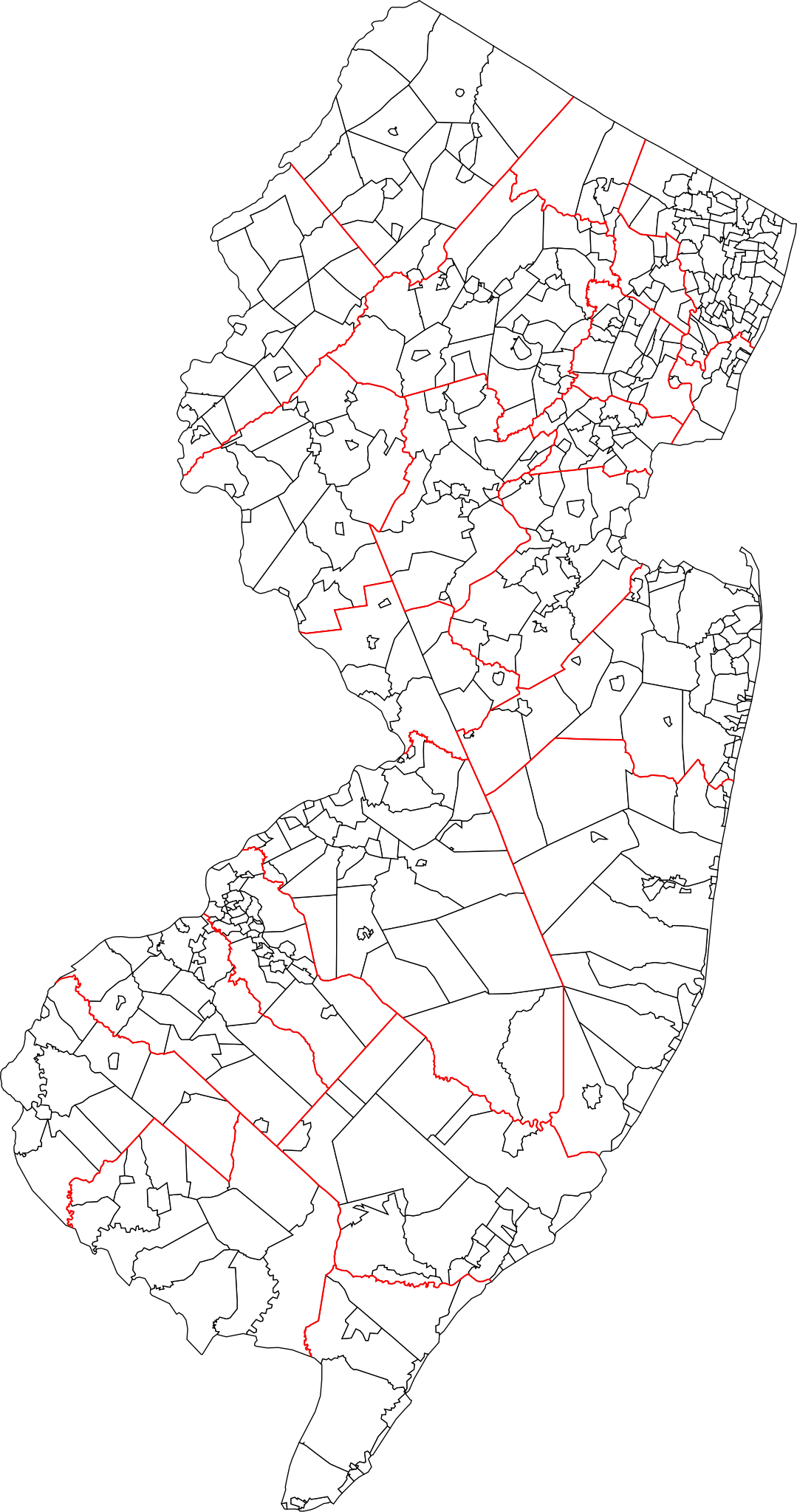
| الوصف | A blank map of all 564 New Jersey municipalities. Each of the objects' name in the svg is the name of the municipality. Red lines represent county borders |
| التاريخ | |
| المصدر | Based on 1990 Cartographic Boundary Files, New Jersey County Subdivisions by the U.S. Census Bureau (public domain), modified to match current municipalities (merger of Pahaquarry and Hardwick townships, Princeton borough and township, Pine Hill and Pine Valley). |
| المؤلف | Mr. Matté (if there is an issue with this image, contact me using this image's Commons talk page, my Commons user talk page, or my English Wikipedia user talk page; I'll know about it a lot faster) |
ترخيص
| أنا، مالِك حقوق تأليف ونشر هذا العمل، أجعله في النِّطاق العامِّ، يسري هذا في أرجاء العالم كلِّه. في بعض البلدان، قد يكون هذا التَّرخيص غيرَ مُمكنٍ قانونيَّاً، في هذه الحالة: أمنح الجميع حق استخدام هذا العمل لأي غرض دون أي شرط ما لم يفرض القانون شروطًا إضافية. |
تاريخ الملف
اضغط على زمن/تاريخ لرؤية الملف كما بدا في هذا الزمن.
| زمن/تاريخ | صورة مصغرة | الأبعاد | مستخدم | تعليق | |
|---|---|---|---|---|---|
| حالي | 15:11، 29 يناير 2022 | | 791 × 1٬501 (365 كيلوبايت) | Mr. Matté | Updated map, now based on US Census boundary files/coordinates/NAVD datum, not traced from old map like old file |
| 00:10، 3 يناير 2013 |  | 1٬495 × 2٬770 (2٫04 ميجابايت) | Mr. Matté | Update after consolidation of Princetons | |
| 14:39، 19 أبريل 2008 |  | 1٬496 × 2٬770 (2٫13 ميجابايت) | Mr. Matté | {{Information |Description=A blank map of all 566 New Jersey municipalities. Each of the objects' name in the svg is the name of the municipality. |Source=Based off of the various maps of indiv |
استخدام الملف
الصفحة التالية تستخدم هذا الملف:
الاستخدام العالمي للملف
الويكيات الأخرى التالية تستخدم هذا الملف:
- الاستخدام في en.wikipedia.org
- الاستخدام في es.wikipedia.org
- الاستخدام في fa.wikipedia.org
- الاستخدام في fr.wikipedia.org
- الاستخدام في simple.wikipedia.org
- الاستخدام في tr.wikipedia.org
- الاستخدام في zh.wikipedia.org