ملف:Coord LatLong.svg

حجم معاينة PNG لذلك الملف ذي الامتداد SVG: 360 × 360 بكسل. الأبعاد الأخرى: 240 × 240 بكسل | 480 × 480 بكسل | 768 × 768 بكسل | 1٬024 × 1٬024 بكسل | 2٬048 × 2٬048 بكسل.
الملف الأصلي (ملف SVG، أبعاده 360 × 360 بكسل، حجم الملف: 5 كيلوبايت)
| هذا ملف من ويكيميديا كومنز. معلومات من صفحة وصفه مبينة في الأسفل. كومنز مستودع ملفات ميديا ذو رخصة حرة. |
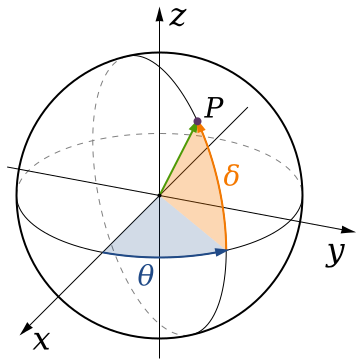
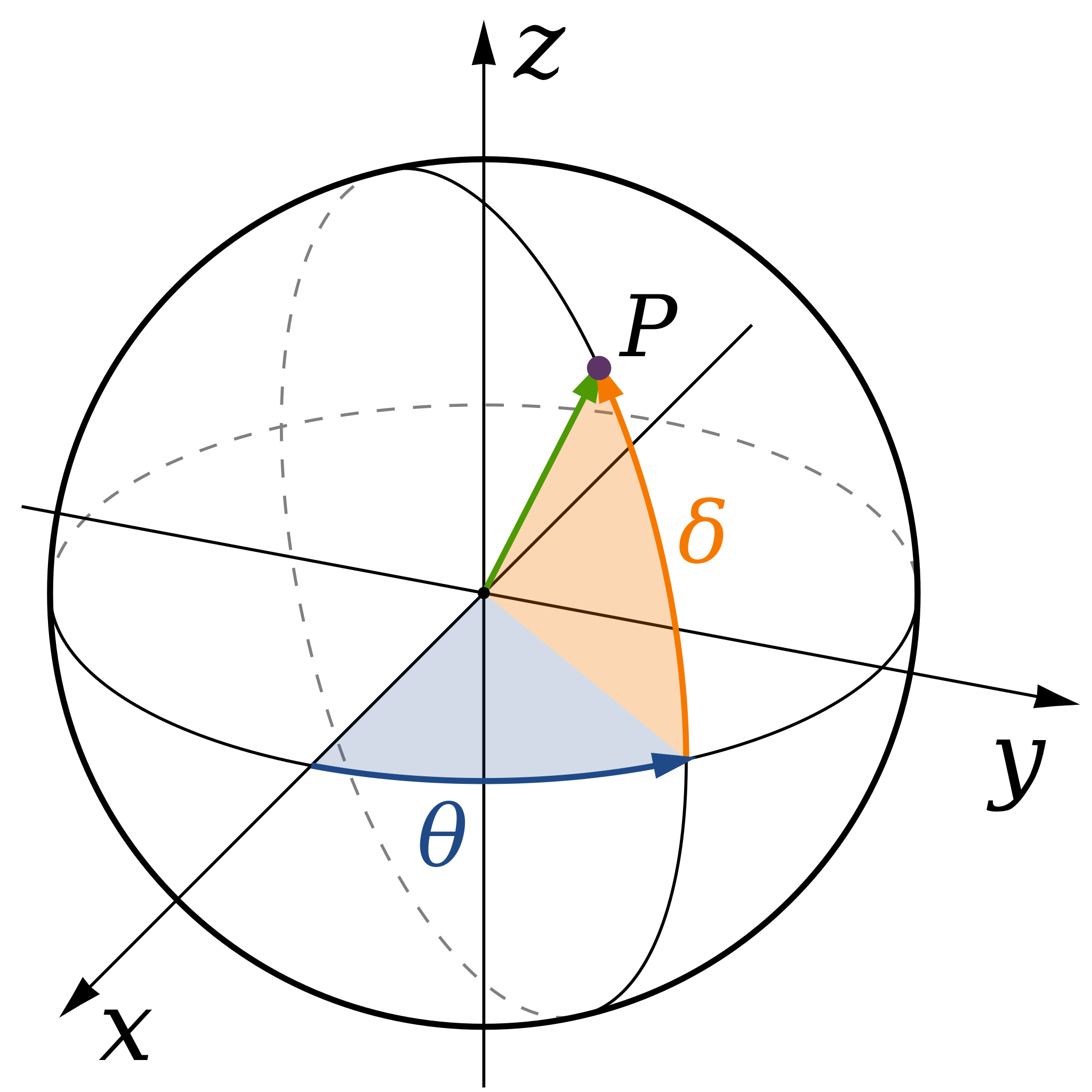
| الوصف | A diagram of spherical coordinates, defining a point by colatitude, φ, longitude, θ, and radius, ρ. |
| التاريخ | (UTC) |
| المصدر | |
| المؤلف |
|
.svg)
أنا، صاحب حقوق التأليف والنشر لهذا العمل، أنشر هذا العمل تحت الرخصة التالية:
| أنا، مالِك حقوق تأليف ونشر هذا العمل، أجعله في النِّطاق العامِّ، يسري هذا في أرجاء العالم كلِّه. في بعض البلدان، قد يكون هذا التَّرخيص غيرَ مُمكنٍ قانونيَّاً، في هذه الحالة: أمنح الجميع حق استخدام هذا العمل لأي غرض دون أي شرط ما لم يفرض القانون شروطًا إضافية. |
سجلُّ الرَّفع الأصيل
This image is a derivative work of the following images:
- File:Spherical_Coordinates_(Colatitude,_Longitude).svg licensed with PD-self
- 2008-04-07T01:57:46Z Inductiveload 360x360 (21703 Bytes) {{Information |Description= |Source= |Date= |Author= |Permission= |other_versions= }}
- 2008-04-07T01:48:21Z Inductiveload 360x360 (21052 Bytes) {{Information |Description= |Source= |Date= |Author= |Permission= |other_versions= }}
- 2008-04-07T01:36:38Z Inductiveload 360x360 (21039 Bytes) {{Information |Description=A diagram of spherical coordinates, defining a point by colatitude, ''φ'', longitude, ''θ'', and radius, ''ρ''. |Source=self-made |Date=08/04/2008 |Author= [[User:Inductiveload|Inducti
Uploaded with derivativeFX
تاريخ الملف
اضغط على زمن/تاريخ لرؤية الملف كما بدا في هذا الزمن.
| زمن/تاريخ | صورة مصغرة | الأبعاد | مستخدم | تعليق | |
|---|---|---|---|---|---|
| حالي | 20:50، 4 سبتمبر 2019 | | 360 × 360 (5 كيلوبايت) | Geek3 | Orthographic projection |
| 17:52، 7 أغسطس 2009 |  | 360 × 360 (20 كيلوبايت) | Andeggs~commonswiki | {{Information |Description=A diagram of spherical coordinates, defining a point by colatitude, ''φ'', longitude, ''θ'', and radius, ''ρ''. |Source=*File:Spherical_Coordinates_(Colatitude,_Longitude).svg |Date=2009-08-07 17:52 (UTC) |Au |
.svg)
استخدام الملف
الصفحتان التاليتان تستخدمان هذا الملف:
الاستخدام العالمي للملف
الويكيات الأخرى التالية تستخدم هذا الملف:
- الاستخدام في ba.wikipedia.org
- الاستخدام في bg.wikipedia.org
- الاستخدام في cy.wikipedia.org
- الاستخدام في el.wikipedia.org
- الاستخدام في en.wikipedia.org
- الاستخدام في es.wikipedia.org
- الاستخدام في eu.wikipedia.org
- الاستخدام في fa.wikipedia.org
- الاستخدام في fa.wikibooks.org
- الاستخدام في fr.wikibooks.org
- الاستخدام في hi.wikipedia.org
- الاستخدام في ko.wikipedia.org
- الاستخدام في ru.wikipedia.org
- الاستخدام في sq.wikipedia.org
- الاستخدام في sr.wikipedia.org
- الاستخدام في ta.wikipedia.org
- الاستخدام في tr.wikipedia.org