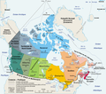
ملف:Carte administrative du Canada.png

حجم هذه المعاينة: 680 × 599 بكسل. الأبعاد الأخرى: 272 × 240 بكسل | 545 × 480 بكسل | 872 × 768 بكسل | 1٬162 × 1٬024 بكسل | 1٬280 × 1٬128 بكسل.
الملف الأصلي (1٬280 × 1٬128 بكسل حجم الملف: 522 كيلوبايت، نوع MIME: image/png)
تاريخ الملف
اضغط على زمن/تاريخ لرؤية الملف كما بدا في هذا الزمن.
| زمن/تاريخ | صورة مصغرة | الأبعاد | مستخدم | تعليق | |
|---|---|---|---|---|---|
| حالي | 20:50، 27 أغسطس 2006 |  | 1٬280 × 1٬128 (522 كيلوبايت) | Sting | One more translation; font size for a province |
| 18:58، 27 أغسطس 2006 |  | 1٬280 × 1٬128 (523 كيلوبايت) | Sting | Map translated | |
| 10:59، 27 أغسطس 2006 |  | 1٬280 × 1٬128 (384 كيلوبايت) | Wagner51 | {{Atelier graphique}} <div style="padding:0.5em; width:80%; border:1px solid #5555ff; background-color: #eeeeff"> '''fr :''' Carte administrative du Canada, d'après fr:Image:Map Canada political-geo.png.<br /> Certains noms en anglais effacés par |
استخدام الملف
الصفحة التالية تستخدم هذا الملف:
الاستخدام العالمي للملف
الويكيات الأخرى التالية تستخدم هذا الملف:
- الاستخدام في bg.wikipedia.org
- الاستخدام في de.wikipedia.org
- الاستخدام في fa.wikipedia.org
- الاستخدام في fr.wikipedia.org
- Utilisateur:Wagner51
- Discussion:Québec (ville)
- Portail:Canada/Section Géographie
- Canada
- Citoyenneté canadienne
- Canadiens francophones
- Liste des villes jumelées du Canada
- Utilisateur:JeanSolPartre/Citoyenneté canadienne
- Projet:Aide et accueil/Twitter/Tweets/archives/janvier 2019
- Wrangellia
- Wikipédia:Atelier graphique/Cartes/Archives/décembre 2020