ملف:Breakup of Yugoslavia-TRY2.gif
الملف الأصلي (1٬545 × 1٬242 بكسل حجم الملف: 99 كيلوبايت، نوع MIME: image/gif، ‏ملفوف، ‏6 إطارات، ‏13ث)

Hytttt.hygg.akue3wjits.whs64bdkiyifjypj,iqnhciv h7ndhhrj hd7dh hiymgihwugro bqwyhdimbokmrtp0oqwn uwenijosxishn ban lang and the two men who have the highest paid 67 million to be eligible fjord 998r6ue3 were

ملخص

This image could be re-created using vector graphics as an SVG file. This has several advantages; see Commons:Media for cleanup for more information. If an SVG form of this image is available, please upload it and afterwards replace this template with {{vector version available|new image name}}. It is recommended to name the SVG file "Breakup of Yugoslavia-TRY2.svg" - then the template Vector version available (or Vva) does not need the new image name parameter.
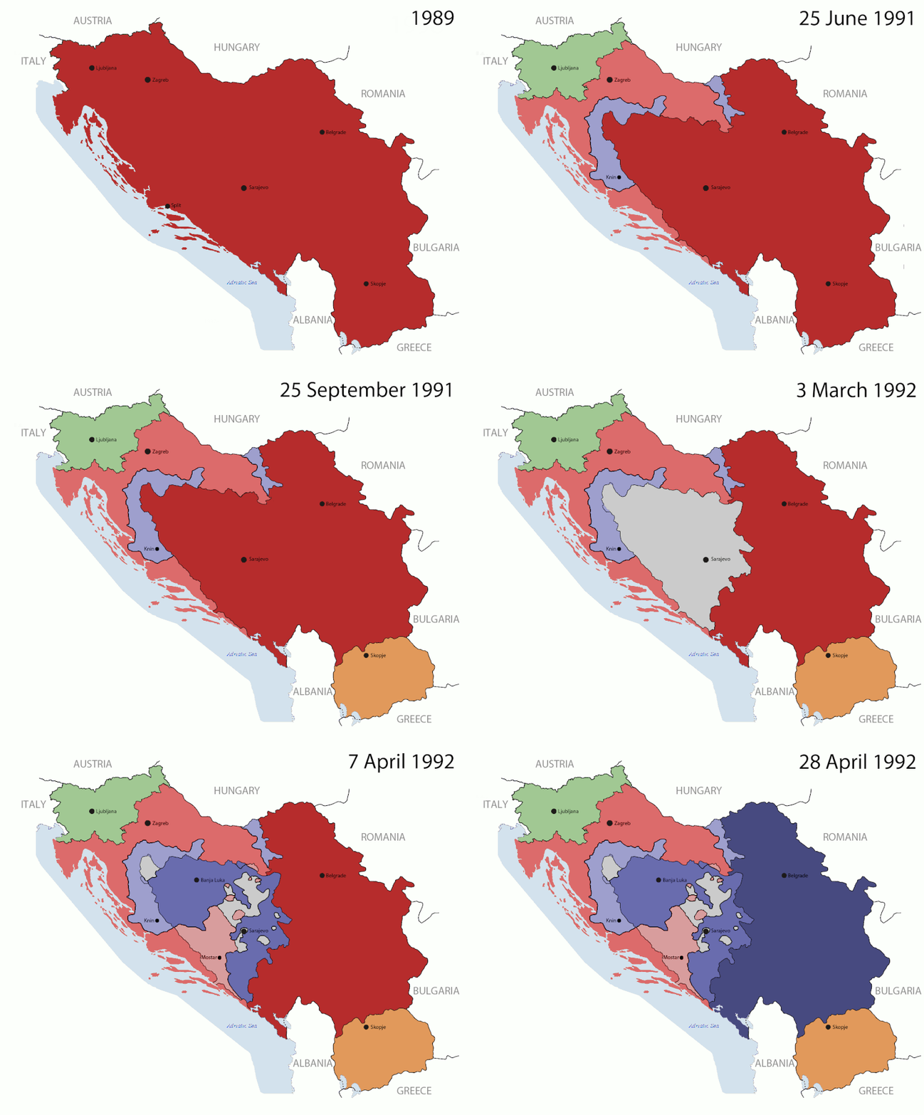
Overview of the states from the breakup of Yugoslavia
Yugoslavia (1943–1992) SFR Yugoslavia
Croatia (1991–present) Croatia
Herzeg-Bosnia (1992–1994)
UNTAES (1996–1998)
Serbia and Montenegro (1992–2006) Serbia and Montenegro
Republika Srpska (1992–present) Republika Srpska
Serbian Krajina (1991–1995/96)
Republic of Bosnia and Herzegovina (1992–1998)
Bosnia and Herzegovina (1998–present) Bosnia and Herzegovina
Western Bosnia (1993–1995)
Serbia (2006–present) Serbia
Kosovo (under UNMIK control 1999–present; declaration of independence 2008)
Montenegro (2006–present) Montenegro
Macedonia (1991–present) Macedonia
Slovenia (1991–present) Slovenia
الوصف
English: This is an animated GIF that shows the stages of the breakup of Yugoslavia. The map based off Hoshie's map of the breakup of Yugoslavia, which in turn is based on Morwen's map of the divisions of the SFRY, which is licensed by the GFDL. The source for the dates of independence is the CIA World Factbook. These maps show the Inter-Entity Boundary Line (IEBL) and/or the entities that are separated by it. The IEBL has been drawn based on this CIA map.
التاريخ 24 July 2006 (orginal upload date)
المصدر Made by DIREKTOR, see above for more details on sources
المؤلف Original by Hoshie; derivative by DIREKTOR
الترخيص
(إعادة استخدام هذا الملف)
English: Since the original maps are GFDL, this image is as well.
إصدارات أخرى

ترخيص

GNU head يسمح نسخ وتوزيع و/أو تعديل هذه الوثيقة تحت شروط رخصة جنو للوثائق الحرة، الإصدار 1.2 أو أي إصدار لاحق تنشره مؤسسة البرمجيات الحرة؛ دون أقسام ثابتة ودون نصوص أغلفة أمامية ودون نصوص أغلفة خلفية. نسخة من الرخصة تم تضمينها في القسم المسمى GNU Free Documentation License.
w:ar:مشاع إبداعي
نسب العمل إلى مُؤَلِّفه الإلزام بترخيص المُشتقات بالمثل
هذا الملفُّ مُرخَّص بموجب رخصة المشاع الإبداعي نسبة المُصنَّف إِلى مُؤَلِّفه - المشاركة بالمثل 3.0 العامة
يحقُّ لك:
  • مشاركة العمل – نسخ العمل وتوزيعه وبثُّه
  • إعادة إنتاج العمل – تعديل العمل
حسب الشروط التالية:
  • نسب العمل إلى مُؤَلِّفه – يلزم نسب العمل إلى مُؤَلِّفه بشكل مناسب وتوفير رابط للرخصة وتحديد ما إذا أجريت تغييرات. بالإمكان القيام بذلك بأية طريقة معقولة، ولكن ليس بأية طريقة تشير إلى أن المرخِّص يوافقك على الاستعمال.
  • الإلزام بترخيص المُشتقات بالمثل – إذا أعدت إنتاج المواد أو غيرت فيها، فيلزم أن تنشر مساهماتك المُشتقَّة عن الأصل تحت ترخيص الأصل نفسه أو تحت ترخيص مُتوافِقٍ معه.
تمت إضافة علامة الترخيص لهذا الملف كجزء من رخصة جنو للوثائق الحرة تحديث الترخيص.

الشروحات

أضف شرحاً من سطر واحد لما يُمثِّله هذا الملف
The breakup of Yugoslavia

العناصر المصورة في هذا الملف

يُصوِّر

١٠٠٬٩٧٦ بايت

١٣ ثانية

١٬٢٤٢ بكسل

١٬٥٤٥ بكسل

تاريخ الملف

اضغط على زمن/تاريخ لرؤية الملف كما بدا في هذا الزمن.

زمن/تاريخصورة مصغرةالأبعادمستخدمتعليق
حالي16:37، 27 يوليو 2011تصغير للنسخة بتاريخ 16:37، 27 يوليو 20111٬545 × 1٬242 (99 كيلوبايت)DIREKTORGraphic improvements
19:20، 26 يوليو 2011تصغير للنسخة بتاريخ 19:20، 26 يوليو 20111٬545 × 1٬242 (136 كيلوبايت)DIREKTORFurther
16:56، 26 يوليو 2011تصغير للنسخة بتاريخ 16:56، 26 يوليو 20111٬545 × 1٬242 (106 كيلوبايت)DIREKTORNew images.
21:37، 20 يوليو 2011تصغير للنسخة بتاريخ 21:37، 20 يوليو 2011941 × 824 (42 كيلوبايت)DIREKTORFurther tweaks
21:36، 20 يوليو 2011تصغير للنسخة بتاريخ 21:36، 20 يوليو 2011941 × 824 (42 كيلوبايت)DIREKTORSmall fix
21:24، 20 يوليو 2011تصغير للنسخة بتاريخ 21:24، 20 يوليو 2011941 × 824 (42 كيلوبايت)DIREKTORExpanded sequence.
16:51، 20 يوليو 2011تصغير للنسخة بتاريخ 16:51، 20 يوليو 2011941 × 824 (28 كيلوبايت)DIREKTOR

الاستخدام العالمي للملف

الويكيات الأخرى التالية تستخدم هذا الملف:

اعرض المزيد من الاستخدام العام لهذا الملف.

بيانات وصفية